GA 3761 – Nerrima Hot on Sale
- Estimated Delivery : Up to 4 business days
- Free Shipping & Returns : On all orders over $200
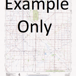
This Topographic Map is produced by Geoscience Australia; Australia s national geospatial organisation.
GA topographic maps (many of which are produced in partnership with the Army) are generally older than those maps produced by the State Governments over the same area. This makes GA maps particularly useful for identifying historic features, such as old mines and diggings.
Geoscience Australia maps generally considered to be more pleasing in design and compilation then the more modern State Government productions.
At this scale, 1cm on this map represents 1km on the ground. A standard map (which is square) covers an area of approximately 54km by 54km, with a contour interval of 20m. This map contains natural and constructed features including road and rail infrastructure, vegetation, hydrography, contours, localities and some administrative boundaries.
Please note the date of the map, as this will impact the currency of information, particularly regarding infrastructure, roads, etc.
Looma New Looma 17 Mile Dam 6 Mile Creek 6 Mile Pool 9 Mile Pool Bamboo Bore Boundary Hills Bowshed Pool Bull Hole Burns Crossing Camballin Carrigan Pool Chappels Bore Charlcutta Bore Coogabing Pool Corner Bore Deep Well Dry Corner Bore Farrels Bore Fitzroy Weir Freney Bore G L Hill Garden Bore Grant Range Half Moon Dam Homestead Bore Honeymoon Spring Howards Bore Howards Yard Jarlmadangah Burru Community Jarran Creek Jimbulara Dam Junedella Waterhole Kings Bore Kokaddadda Bore Lake Daley Lake Josceline Leos Bore Ligligin Waterhole Little Flow Bore Liveringa Liveringa Ridge Lomans Bore Looma Community Looma Remote Community School Loongadda Pool Macalears Bore Manaroo Pool Mauds Bore Mawleys Bore Mia Mia Bore Mills Bore Montgomery Bore Moores Bore Mores Bore Moulamen Hill Mount Arthur Mount Bessel Mount Density Mount Freney Mount Hamer Mount Wynne Myroodah Myroodah Airfield Myroodah Crossing Nerrima Nerrima Creek Nerrima Outcamp Nerrima Ridge No. 1 Bore No. 2 Bore No. 3 Bore Nura Nura Crossing Nura Nura Ridge Rig Bore Rocky Hole Rose Hill Skinners Pool Snake Creek Snake Hill Spinifex Tank Tutu Bore Upper Liveringa Airfield Upper Liveringa Pool Uralla Creek Wapet Bore Waterford Bore Watsons Bore Websters Bore Woolabudda Crossing Woolabudda Pool Yallamungie Pool Jimberlura Tank Spinifex Lomans Tank Upper Liveringa Seventeen Mile Dam Freneys Bore Mount Wynne Creek Myrooda Luluigui Four Mile Bore Woolabudda Out Camp Tarringan Hole Top Pindan Out Camp Bambu Bore Moulamen Hill South
| Title | Paper, Laminated |
|---|
Related products
-
GA 5436-1 – Bilby Online
$12.50